South Africa’s urban landscape defies the fundamental rules of economic geography. A new analysis reveals that the nation’s city sizes do not follow the expected mathematical patterns, exposing a deep structural flaw. This deviation from Zipf’s Law highlights the persistent spatial inequality that continues to hamper economic growth.
The Mathematical Reality of Urban Growth
Zipf’s Law is a simple but powerful rule in urban economics. It states that the second largest city in a country is typically half the size of the largest, the third is a third the size, and so on. In a perfectly balanced system, this distribution allows for efficient resource allocation and labor mobility. South Africa’s cities, however, tell a different story.

The data shows a stark deviation from this natural order. Johannesburg remains a dominant mega-city, but the subsequent cities do not scale down in the predictable manner seen in the United States or Europe. This imbalance suggests that the country’s urban hierarchy is frozen in time, reflecting historical policies more than current economic dynamics. The result is a rigid structure that stifles regional development.
Economists argue that this pattern is not accidental. It is the direct result of decades of planning that concentrated wealth and infrastructure in specific nodes. The lack of intermediate-sized cities creates bottlenecks in the labor market. Workers are forced to migrate to the largest hubs, overcrowding them while leaving smaller towns underutilized.
Historical Roots of Spatial Segregation
The current urban structure is a legacy of the Apartheid era. Policies such as the Group Areas Act and Bantustan system deliberately fragmented the urban fabric. These laws forced Black South Africans into specific zones, often far from economic centers. The effects of these policies have persisted long after the political transition in 1994.
The Legacy of Township Planning
Townships were often designed as dormitory settlements rather than integrated economic zones. This meant that residents lived in proximity to jobs but lacked access to the same amenities and infrastructure as suburban areas. The spatial mismatch remains a critical issue today. Many workers still spend hours commuting from townships to central business districts.
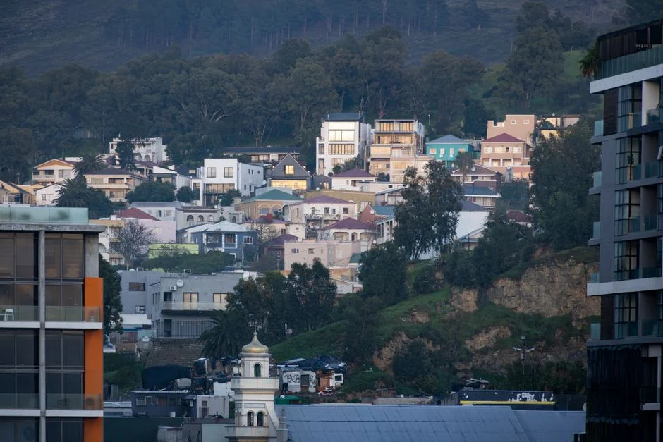
Post-Apartheid governments have struggled to reverse this trend. While housing programs have built millions of units, they often extended the urban sprawl without improving connectivity. The result is a dual city model. One city thrives with modern infrastructure, while the other struggles with basic services. This duality is clearly visible in cities like Cape Town and Durban.
Economic Consequences of the Spatial Divide


The deviation from Zipf’s Law has tangible economic costs. When cities do not grow in a balanced way, productivity suffers. The concentration of talent in a few large cities creates inefficiencies in the labor market. Small and medium enterprises in secondary cities struggle to find skilled workers. This limits their ability to compete in the broader economy.
Infrastructure spending also becomes less efficient. The government must invest heavily in transport networks to connect disparate urban areas. This drains resources that could be used for education or healthcare. The cost of commuting for the average worker is rising, eating into disposable income. This reduces consumer spending power across the country.
Business leaders are increasingly vocal about the issue. The Business Unity Forum has highlighted spatial mismatch as a key driver of unemployment. They argue that without reforming the urban structure, job creation will remain stagnant. The current model favors large corporations in major hubs, leaving smaller players behind.
Comparative Perspectives on Urban Development
Looking at the United States offers a useful contrast. American cities generally follow Zipf’s Law more closely. This allows for a more fluid labor market. Workers can move between cities with relative ease, finding opportunities that match their skills. The diversity of city sizes provides multiple entry points for economic participation.
South Africa lacks this flexibility. The gap between the largest and second-largest cities is wider than expected. This suggests that Johannesburg dominates the economic landscape to an unusual degree. Other cities like Cape Town and Durban are significant but do not provide the same level of alternative opportunities. This concentration increases risk for the national economy.
Experts note that this pattern is common in developing nations. However, South Africa’s case is unique due to the intensity of historical intervention. The spatial divide is not just a result of market forces. It is a constructed reality that requires deliberate policy to correct. Ignoring this fact leads to ineffective urban planning.
Policy Responses and Urban Reform
The South African government has launched several initiatives to address spatial inequality. The New Urban Agenda aims to integrate townships with central business districts. This involves investing in public transport and mixed-use developments. The goal is to create more cohesive urban environments. However, progress has been slow and fragmented.
The Department of Human Settlements plays a key role in this process. They are responsible for coordinating housing and infrastructure projects. Recent budgets have allocated more funds to urban renewal. Yet, critics argue that the scale of investment is insufficient. The pace of change lags behind the rate of urbanization.
Local governments also have significant influence. Cities like Johannesburg and Cape Town have implemented their own spatial strategies. These include tax incentives for development in key corridors. They also focus on upgrading informal settlements. These local efforts show promise but need more national support to scale up.
The Role of Transportation Infrastructure
Transport is the lifeline of any city. In South Africa, the transport system reflects the spatial divide. The Bus Rapid Transit networks in Johannesburg and Cape Town are models of efficiency. However, they cover only a fraction of the urban area. Many workers still rely on minibus taxis, which can be expensive and unreliable.
Investing in rail and road infrastructure is critical. The Gautrain has demonstrated the potential of rapid rail links. It has connected key economic nodes in Gauteng province. Expanding this model to other regions could reduce commuting times. This would increase productivity and improve quality of life for residents.
However, funding remains a challenge. The national budget is under pressure from various sectors. Competing priorities often push transport projects to the back burner. Public-private partnerships are being explored as a solution. These can bring in additional capital and expertise. But they require clear regulatory frameworks to be effective.
Social Impacts and Community Resilience
The spatial divide affects more than just economics. It shapes social interactions and community cohesion. Segregated neighborhoods limit opportunities for social mixing. This can reinforce stereotypes and reduce social trust. Integrated urban spaces can help bridge these divides. They provide common ground for people from different backgrounds.
Education and healthcare access are also influenced by location. Schools in township areas often face resource constraints. This affects the quality of education for children. Healthcare facilities may be overcrowded or understaffed. Improving spatial integration can help distribute these services more evenly. This would lead to better outcomes for the population.
Community groups are playing an active role in advocating for change. They organize protests and campaigns to demand better services. Their efforts have brought attention to local issues. This grassroots pressure is essential for driving policy reform. It ensures that urban planning reflects the needs of residents.
Future Outlook and Key Indicators
The path forward requires coordinated action. National and local governments must align their strategies. Private sector investment is also crucial. A multi-stakeholder approach can leverage resources and expertise. This will help create more inclusive and efficient cities. The goal is to build a resilient urban system that supports economic growth.
Monitoring progress is essential. Key indicators include commuting times, housing affordability, and job creation rates. These metrics will show whether policies are working. Regular assessments can help adjust strategies as needed. Transparency in data collection will also build public trust. This will encourage greater participation in urban planning.
The next five years are critical for South Africa’s urban future. Several major infrastructure projects are scheduled for completion. These include new rail lines and housing developments. Their impact will depend on effective implementation and maintenance. Stakeholders should watch for signs of improved connectivity and integration. These changes will determine whether the spatial divide begins to close.
See Also
Future Outlook and Key Indicators The path forward requires coordinated action. Key indicators include commuting times, housing affordability, and job creation rates.